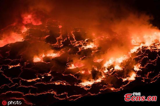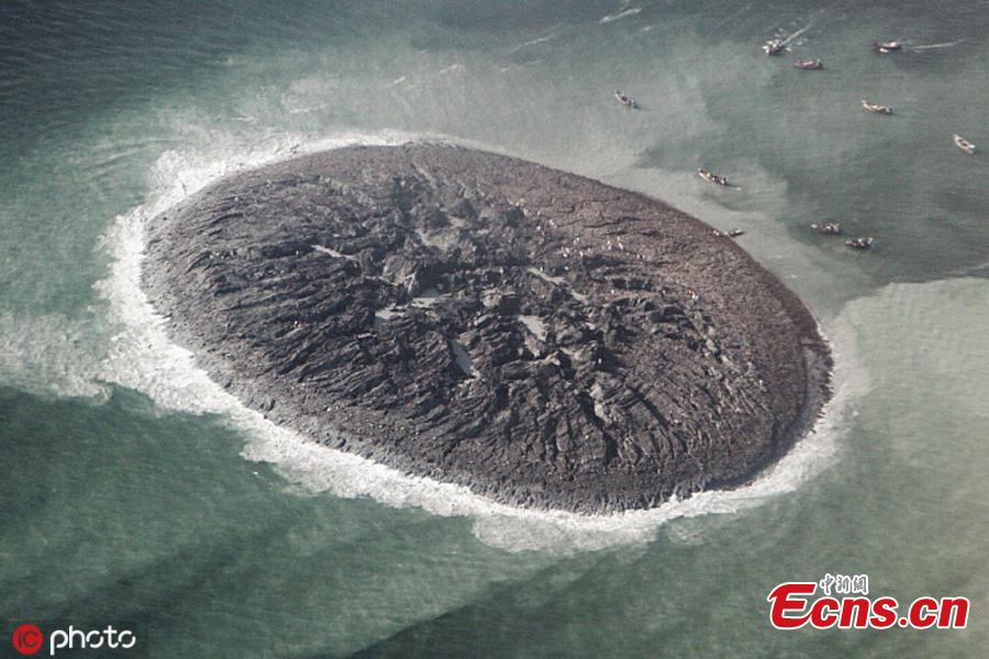
After a 7.7 magnitude earthquake shook western Pakistan in September 2013, an oval-shaped island sprang up in a shallow bay near the port city of Gwadar. The island, called Zalzala Koh (Earthquake Mountain in Urdu) was the product of a mud volcano triggered by the earthquake. At the time, geologists said the tiny island—20 meters high, 90 meters wide, and 40 meters long—would not last long when faced with waves and tides that would chip away at the muddy, silty feature. (Photo/IC)
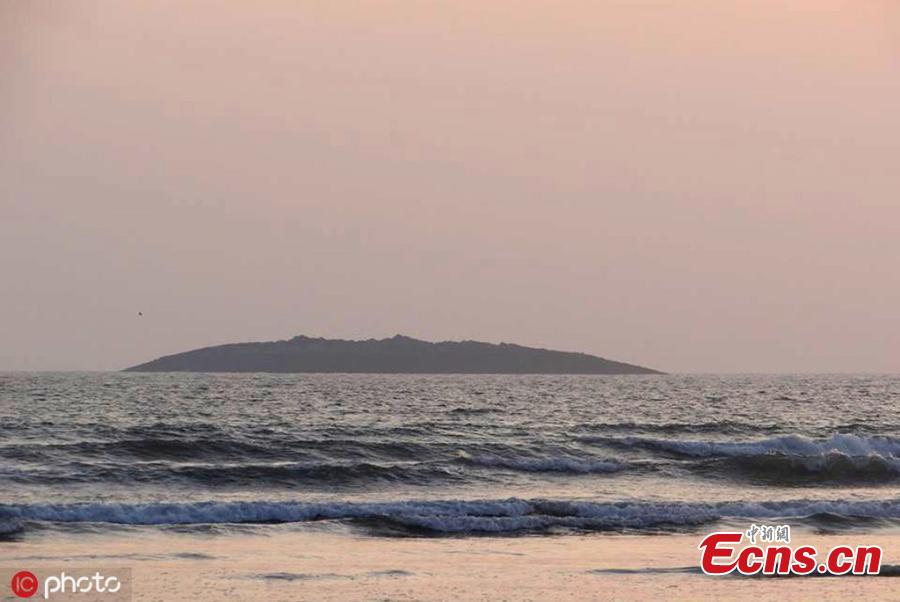
After a 7.7 magnitude earthquake shook western Pakistan in September 2013, an oval-shaped island sprang up in a shallow bay near the port city of Gwadar. The island, called Zalzala Koh (Earthquake Mountain in Urdu) was the product of a mud volcano triggered by the earthquake. At the time, geologists said the tiny island—20 meters high, 90 meters wide, and 40 meters long—would not last long when faced with waves and tides that would chip away at the muddy, silty feature. (Photo/IC)
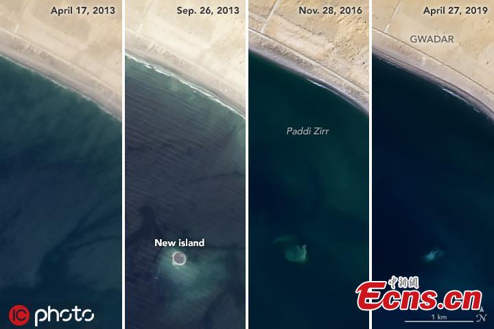
After a 7.7 magnitude earthquake shook western Pakistan in September 2013, an oval-shaped island sprang up in a shallow bay near the port city of Gwadar. The island, called Zalzala Koh (Earthquake Mountain in Urdu) was the product of a mud volcano triggered by the earthquake. At the time, geologists said the tiny island—20 meters high, 90 meters wide, and 40 meters long—would not last long when faced with waves and tides that would chip away at the muddy, silty feature. (Photo/IC)
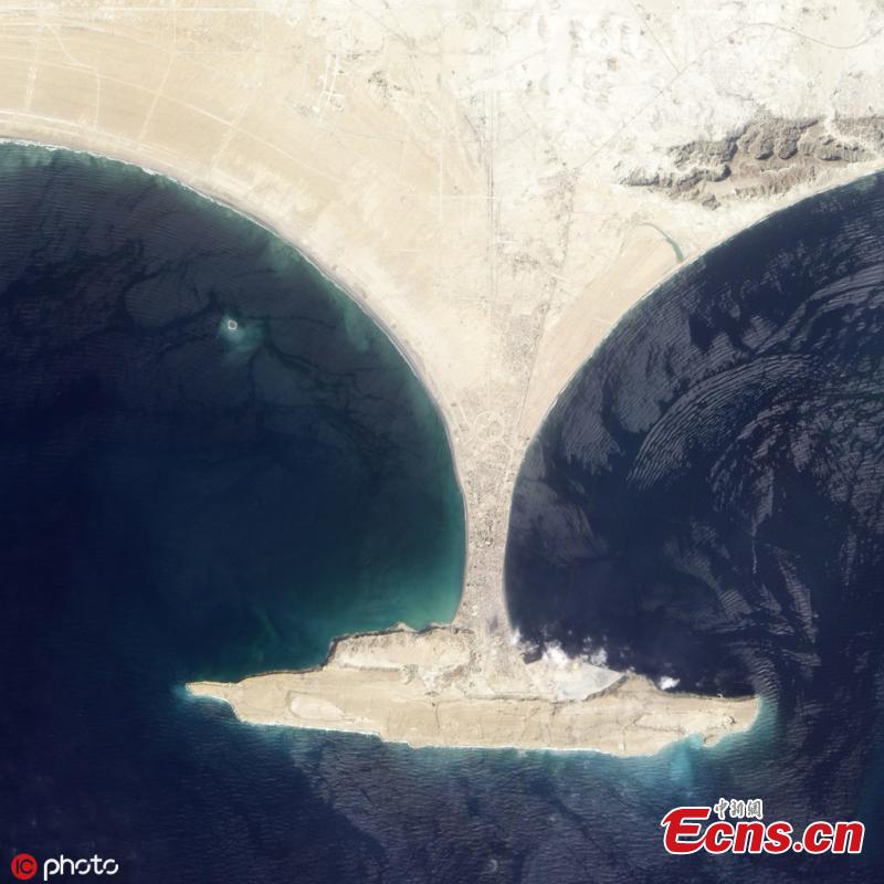
After a 7.7 magnitude earthquake shook western Pakistan in September 2013, an oval-shaped island sprang up in a shallow bay near the port city of Gwadar. The island, called Zalzala Koh (Earthquake Mountain in Urdu) was the product of a mud volcano triggered by the earthquake. At the time, geologists said the tiny island—20 meters high, 90 meters wide, and 40 meters long—would not last long when faced with waves and tides that would chip away at the muddy, silty feature. (Photo/IC)