LINE

Text:AAAPrint
Photo

Chinese cities in hi-res SAR images(4/4)

2016-08-26 08:53 CRIENGLISH.com Editor:Li Yan
1

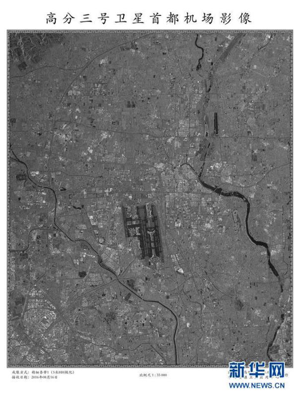
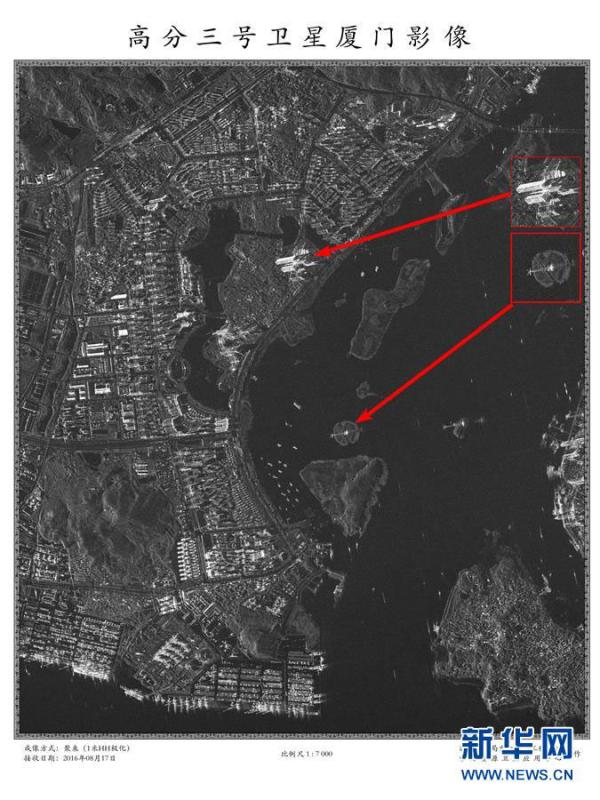
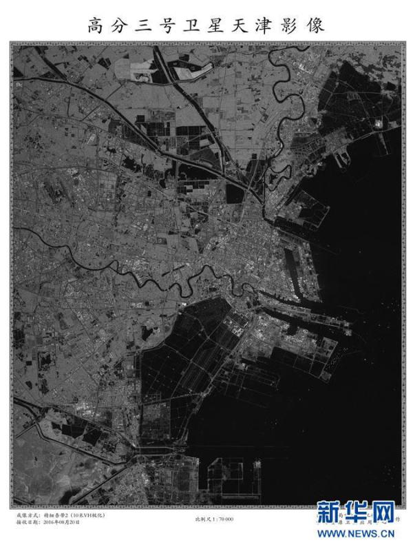
A Long March 4C rocket carrying a new high-resolution Synthetic Aperture Radar (SAR) imaging satellite blasts off at the Taiyuan Satellite Launch Center in Taiyuan, capital of north China's Shanxi Province, Aug. 10, 2016. As China's first SAR imaging satellite that is accurate to one meter in distance, it covers the globe with an all-weather, 24-hour observation service and will be used for disaster warning, weather forecasting, water resource assessments and protection of maritime rights. (Photo/Xinhua)

Prev Button Next Button
LINE
News
Politics
Business
Society
Culture
Military
Sci-tech
Entertainment
Sports
Odd
Features
Biz
Economy
Travel
Travel News
Travel Types
Events
Food
Hotel
Bar & Club
Architecture
Gallery
Photo
CNS Photo
Video
Video
Learning Chinese
Learn About China
Social Chinese
Business Chinese
Buzz Words
Bilingual
Resources
ECNS Wire
Special Coverage
Infographics
Voices
LINE
Back to top Links | About Us | Jobs | Contact Us | Privacy Policy
Copyright ©1999-2018 Chinanews.com. All rights reserved.
Reproduction in whole or in part without permission is prohibited.