


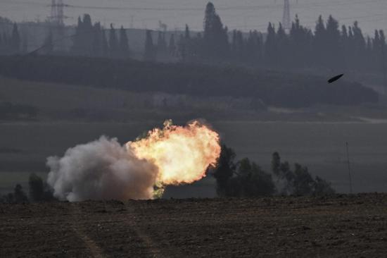
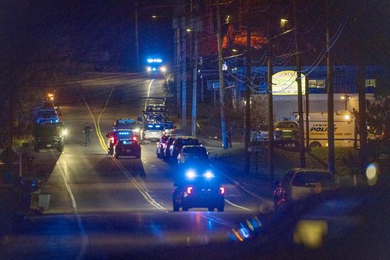
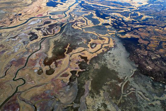
High-resolution nighttime light images show the worsening power supply situation in the Gaza Strip on Oct 11 (center) and Oct 12 (right), compared with Sept 14 (left). (Provided to China Daily)
A team of Chinese researchers from Hubei province has helped the United Nations map the scale of power blackouts in the besieged Gaza Strip, using nighttime remote sensing technology.
The discoveries can be used to fine-tune global relief efforts aimed at easing a rapidly worsening humanitarian crisis in the coastal enclave, said Li Xi, the project's lead scientist.
Li, a professor at Wuhan University's School of Remote Sensing and Information Engineering, now heads the State Key Laboratory of Information Engineering in Surveying, Mapping and Remote Sensing on campus.
On Oct 8, a day after the conflict broke out between Palestine and Israel, Li reached out to Origin Space, a technology startup in Nanjing, Jiangsu province, for fresh satellite images of Gaza.
In the early hours on Oct 11, a commercial satellite owned by the company captured a high-resolution nighttime light image of Gaza, the first of many to follow. Analyses of the images led to a grim conclusion: The power supply in Gaza had dwindled after Oct 7.
"The changes in nighttime lights can reflect fluctuations in electricity supply, and they can be used to assess the impact of a range of disasters and conflicts," Li said.
According to the analysis, as of mid-October, vast swaths of Gaza were facing massive power outages. The power supply had declined by more than 90 percent in most areas compared with pre-conflict levels.
By Oct 21, more than 80 percent of buildings in Gaza had no power supply. Only hospitals and other healthcare facilities had access to electricity.
Among the five governorates in the Gaza Strip — North Gaza, Gaza City, Deir Al Balah, Khan Younis and Rafah, the southernmost Rafah region faced the least disruptions in power supply, the study said.
The power supply had not been restored even in late October, it said.
The findings were outlined in three reports drafted since early October by Li and two of his students, Cao Hanrui and Jia Minghui, in partnership with the United Nations Satellite Center, known as UNOSAT. First produced for the UN's internal discussions, the reports were made public starting in mid-October.
Li said his connections with UNOSAT go back a decade.
In 2013, Li reached out to the organization through LinkedIn. The professor had advertised his latest research on the application of nighttime remote sensing technology in evaluating damage inflicted by disasters. A month later, he received a message from Lars Bromley, a chief analyst at UNOSAT, seeking cooperation.
As part of the long-running partnership, analyses of satellite images by Li and his colleagues have been used to plan a range of relief efforts, including in Iraq in 2018, in quake-ravaged Turkiye in February, and in Sudan in the aftermath of an armed conflict that broke out in April.
"The places in the world that need help often happen to be the areas where nighttime remote sensing technology can be most useful," Li said.


 京公网安备 11010202009201号