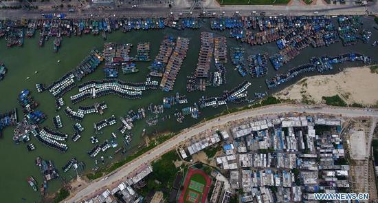
Aerial photo taken on Sept. 14, 2018 shows fishing boats returning to harbor at a fishing port in Sanya, south China's Hainan Province. Mangkhut, the 22nd typhoon this year, is expected to land in south China's Guangdong and Hainan provinces on the night of Sept. 16. (Photo/Xinhua)
With winds of 234 km/h, typhoon may become strongest this year
Typhoon Mangkhut, which may become the most powerful typhoon this year, is expected to land in South China on Sunday night, according to meteorological authorities on Friday.
The China Meteorological Administration said that Typhoon Mangkhut is on course to hit the western part of Guangdong province and northeast Hainan province. Mangkhut will move westward after landing and may weaken from a super typhoon to severe typhoon.
At a meeting on Friday, Ye Jianchun, secretary-general of the State Flood Control and Drought Relief Headquarters and vice-minister of water resources and emergency management, urged local governments to monitor the typhoon and release warnings in a timely manner. Local governments should evacuate residents at risk soon. The headquarters has dispatched work groups to Guangdong, Hainan, Fujian and Yunnan provinces and the Guangxi Zhuang autonomous region to help local governments prepare for the typhoon, according to the meeting.
Zhang Ling, chief forecaster with the CMA, said that Mangkhut intensified into a super typhoon on Tuesday with sustained winds of 234 kilometers per hour near the center after being tracked in the Pacific on Sept 7.
People in southern parts of China and the Hong Kong and Macao special administrative regions, will be at the most risk.
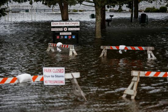
The typhoon's massive raincloud band reaches 1,000 kilometers and will bring strong wind and intense rains to the areas, according to the authorities.
Precipitation in southern parts of China - Hong Kong, for example - will reach about 20 centimeters, while several districts may reach up to 45 centimeters, authorities predicted on Friday.
These disaster-prone areas are coordinating preparations for the upcoming super typhoon, according to Xinhua News Agency.
Mangkhut will be the second typhoon to hit Hong Kong this week and may be the strongest ever.
John Lee, Hong Kong's Secretary for Security, ordered all emergency response departments to have their deployment and emergency response plans ready for possible threats.
Macao's Marine and Water Bureau warned all ports and ships to be alert about the coming storm and operate with caution, Xinhua reported, while the Civic and Municipal Affairs Bureau has started removing all lanterns and decorations for Mid-Autumn Festival, which may threaten people's safety. The festival falls on Sept 24.
Xinhua contributed to this story.