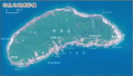
A satellite remote sensing image of the Diaoyu Island released by the latest landform survey report. (Photo/China's Ministry of Natural Resources)
China's Ministry of Natural Resources on Monday published a landform survey report on the Diaoyu Island and its affiliated islands.
Based on historical data, the survey obtained new terrain data of the Diaoyu Island and its affiliated islands, as well as the terrain data of waters 30 meters or less in depth, using technology such as satellite remote sensing.
The report also made large-scale topographical thematic maps of the Diaoyu Island and its affiliated islands, improving basic geographic data of the area.
The survey is of great significance to the resource management and ecological environment protection of the Diaoyu Island and its affiliated islands, according to the report.