Archival map reveals Japanese invasion attempts(4/5)
2014-09-18 09:37
Ecns.cn
Web Editor:Yao Lan
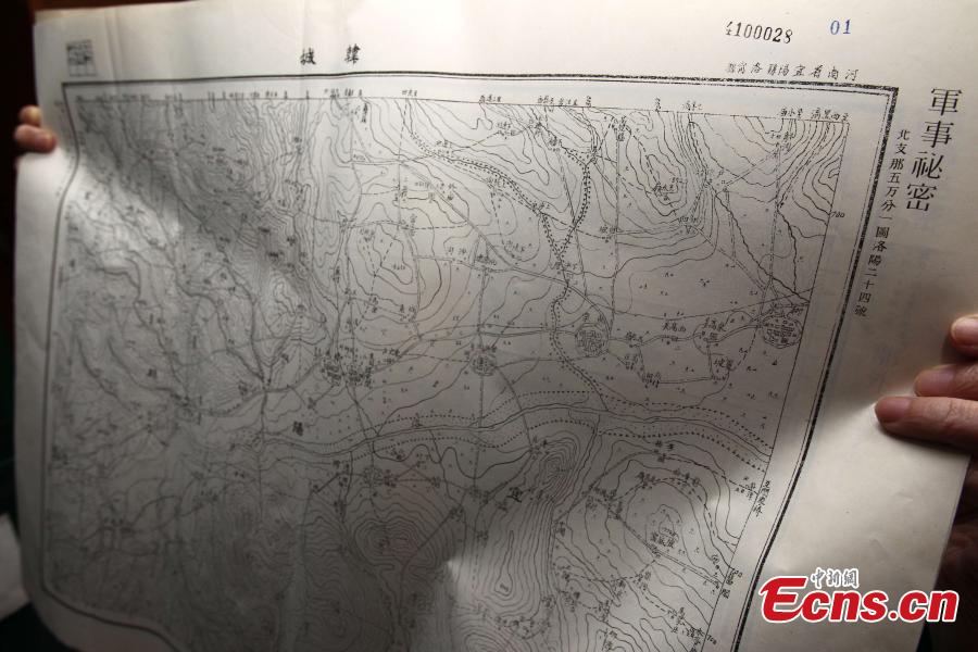
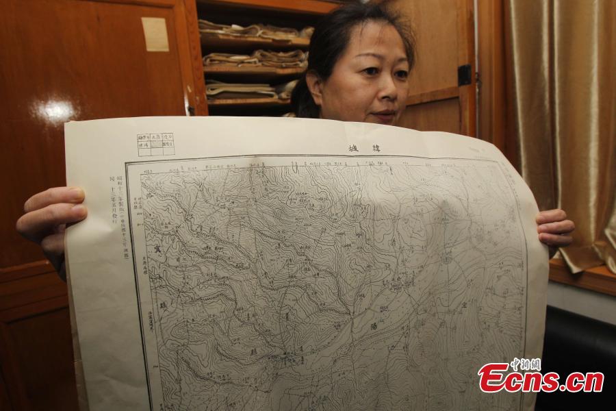
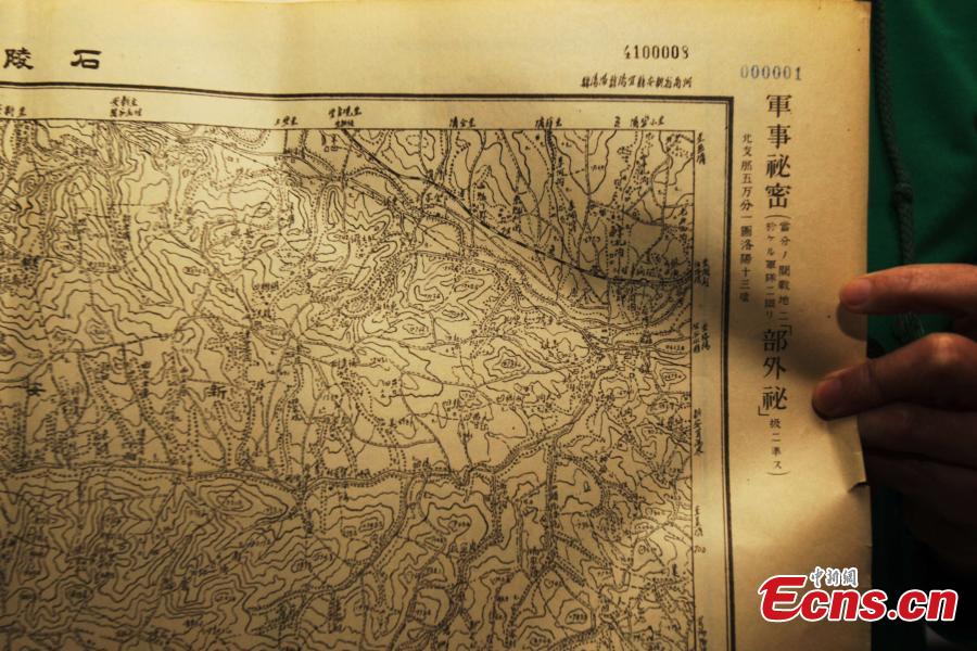
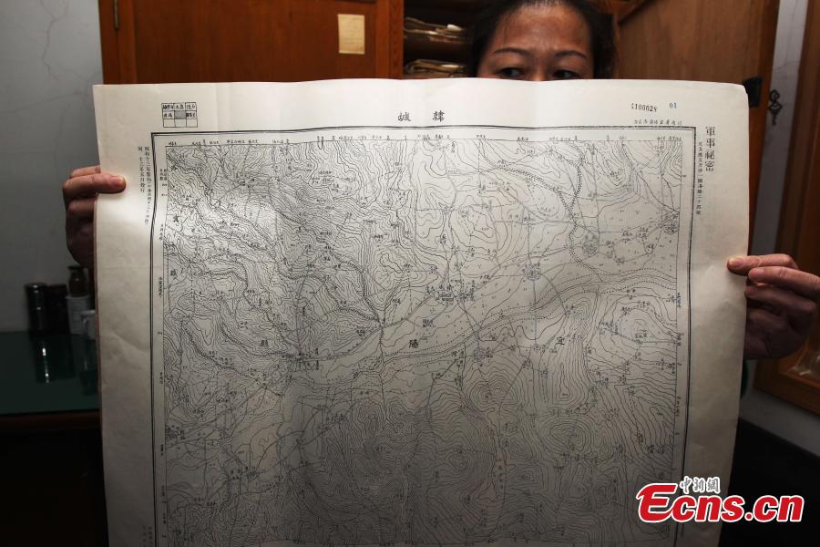
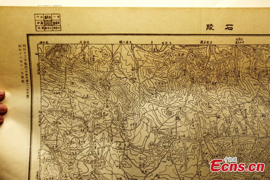
An employee of Administration of Surveying, Mapping and Geoinformation of Central China’s Henan province shows a military map drawn by Japanese army during the Japanese war of aggression against China on Wednesday, September 17, 2014. The detailed topographical map of China is marked with a measuring scale of 1:50,000. The map is exhibited to commemorate the 83rd anniversary of the "9.18 Incident," or "Mukden Incident," which marks the beginning of the 14-year war against Japanese aggression. On September 18, 1931, Japanese troops blew up a section of the railway under their control near Shenyang, and then accused Chinese troops of sabotage as a pretext for attack. They bombarded barracks near Shenyang the same evening, beginning a large-scale armed invasion of northeast China. [Photo: China News Service/ Wang Zhongju]