


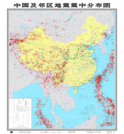
(ECNS) �C The latest version of an earthquake epicenter distribution map for China and its neighboring areas, compiled by the China Earthquake Networks Center, has been published by the Seismological Press.
The map contains nearly 40,000 earthquake entries, including quakes with a magnitude of four and above that occurred between the 23rd century B.C. and 1969, of three and above that occurred between 1970 to the end of 2014, and of five and above that occurred in China's surrounding areas between 1900 to the end of 2014.
Red dots are used to mark the quakes that struck from 1900 to 2014, while green dots are used for those before 1900.
For quakes with a magnitude of six or above on the Chinese mainland and seven or above in Taiwan and China's neighboring areas, the specific magnitudes and dates are also given.
In addition, dark solid borders are used to mark epicenters at a depth of 70 to 300 kilometers, while dark solid borders with slants refer to epicenters at a depth of more than 300 kilometers.


